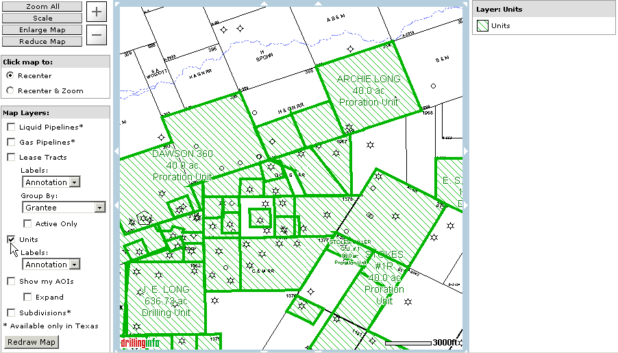
Drillinginfo currently has unit outlines available for some Texas counties only. To see a complete list of counties please visit the Products page and/or to subscribe to this product contact Drillinginfo Sales.
The unit outlines are gathered from the following sources at the TX Railroad Commission: W-1 forms (Drilling Units), P-12 forms (proration units) and P-15 forms (pooled units). Scanned images from these source documents may be accessible via the hub page and/or links in the Table View
To view units on your map please select the Units checkbox from the Map Layers men located to the left of the map. Units will always be displayed in green with diagonal stripes.

Next select the preferred labeling method from the Labels drop down menu:
Annotation
This will label the units with Unit Name, the acreage and the unit type.
Footnotes
This will assign a number to the unit. The footnotes will then be accessible via the Table View.
Small units may not have an assigned footnote number if the footnote marker on the map would cover up the majority or all of the unit. These units will be visible in the Table View.
None
No labeling will be applied to the map
After checking the Units box and selecting the desired labels click REDRAW MAP.
Helpful Tips:
As you zoom in you will see more and more detail
The unit data visible in the map will also be available in the Table View
You can export the unit polygons and other map layers as Shape Files. For additional help on shape file exports click here.
You can click directly on a unit to open up a detail page and locate additional information.
The color legend for units is displayed to the right of the map.