The ability to export shape files is available for some accounts with a subscription to our DI LandTrac product.
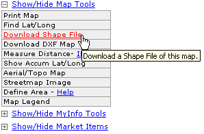
To export shape files from the Map View click the Download Shape File link in the Map Tools menu located to the lower left of the map.

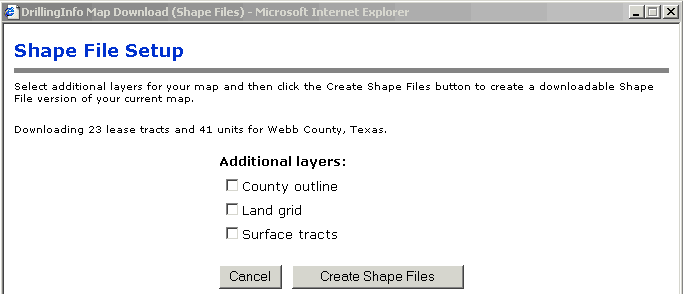
After clicking the link you will be prompted to select the layers you desire for export:

Note: It will automatically grab any lease tract and/or unit outlines from the current map view, but it gives you the option of downloading the following additional layers:
County Outline - an outline of the current county
Land Grid - the Drillinginfo base map including S/T/R or abstract/survey information
Surface Tracts - available in limited TX counties only
After clicking the Create Shape File button you may be prompted to enter billing information to complete the download. Enter your billing information to continue the download.
If you are not prompted to enter billing information simply wait for the prompt to open or save the file.
When prompted to open or save the file we strongly recommend using the SAVE option. After opening or saving the zipped files you are ready to import them into the GIS package of your choice.
The dowloaded files will look something like the screen shot below:

Mineral Tract files contain lease tract information
Producing Units files contain TX unit information
Counties files will contain county outlines
Surface Tract files will contain surface tract information
Surveys files will contain land grid information
Click here for help with Lease Tracts.
Click here for help with Units.